Study remote sensing and Earth observation online.
Join us online for a practical introduction to remote sensing and Earth observation.
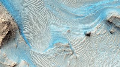
In this Masters-level online short course, you’ll discover how satellite, aerial, and drone imagery can be used to understand the Earth’s surface, monitor environmental change, and support informed decision-making in a range of sectors.
With expert guidance, you’ll develop the skills you need to acquire, process, analyse, and interpret remotely sensed data.
Cover the full remote-sensing workflow
We’ll guide you through the whole process, from data acquisition to interpreting and communicating your findings.
You’ll learn about:
- the principles behind modern Earth observation technologies
- a range of remote sensing platforms and sensor systems
- image processing, resolution, and enhancement
- how to analyse and interpret remote-sensing data, both visually and digitally.
Hands-on learning
You’ll work with real-world imagery and through regular practical sessions will build the confidence and expertise to work with remote sensing data in professional and research settings.
Develop skills for a range of careers
You’ll develop skills that are directly relevant to modern geospatial careers.
You’ll learn to contribute to projects that use Earth observation data in sectors including environmental management, natural resources, agriculture, forestry, urban planning, disaster management, and climate science.
Who can join this online remote sensing course?
This distance-learning course is aimed at professionals and graduates from a range of related disciplines, including:
- Geography
- Engineering
- Environmental Science
- Computing Science, and
- Geology.
The course is designed to help you enhance your employability in environmental, geospatial, and research careers, as well as build a foundation for further study and professional development in remote sensing and GIS.

Build credits towards a Masters degree
This online short course is part of:
You can use the credits you earn with this course towards this MSc qualification.
What you’ll study
This course gives you a comprehensive introduction to the principles, methods, and applications of remote sensing.
In this course, you’ll cover the full workflow, from data acquisition through to image processing, analysis, and interpretation.
The course provides a strong conceptual and practical foundation in remote sensing, preparing you for progression to advanced geospatial analysis.
We’ll integrate satellite, aerial, and UAV imagery within a unified framework of Earth observation.
This ensures you’ll understand remote sensing as a multi-scale and multi-platform discipline rather than a set of isolated technologies.
You’ll cover topics including:
Fundamentals of remote sensing and Earth observation
- Including electromagnetic radiation, energy interactions with the Earth’s surface, sensor systems, spatial and spectral resolution, and image acquisition methods.
- How remote sensing data are captured using satellite platforms, airborne sensors, and UAV systems.
Types of remote sensing data and sensor technologies
- Including multispectral, hyperspectral, thermal, radar and lidar.
- Data characteristics, quality, and limitations, and how these influence interpretation and analysis.
Image pre-processing and post-processing
- Essential techniques including radiometric correction, geometric correction, image enhancement, mosaicking, and classification preparation.
- These skills ensure that raw imagery is transformed into reliable datasets suitable for analysis.
UAV-based remote sensing
- Data acquisition principles, flight planning considerations, image capture, and post-processing of UAV imagery.
- Generating orthomosaics and understanding structure-from-motion concepts.
- Integrating UAV-derived products into GIS workflows.
Image analysis and interpretation techniques
- Including supervised and unsupervised classification, change detection, vegetation indices, and land cover mapping.
- Applying these methods using real-world datasets to see how remote sensing supports environmental monitoring, urban analysis, and resource management.
Practical skills development
We’ll use practical exercises throughout the course to help you understand theoretical concepts, and enable you to work with real satellite and UAV datasets.
You’ll learn how to extract meaningful information from imagery and apply remote sensing techniques to solve spatial problems.
By the end of this remote sensing course, you’ll be able to...
-
Explain the principles of remote sensing, including electromagnetic radiation and sensor systems.
-
Describe data acquisition methods across satellite, aerial, and UAV-based remote sensing platforms.
-
Apply image pre-processing and post-processing techniques to remote sensing datasets.
-
Analyse and interpret remote sensing imagery for environmental and spatial applications.
-
Create GIS workflows integrating UAV-derived data in spatial analysis and mapping.
-
Communicate remote sensing results effectively to both technical and non-technical audiences.
Choose the University of Aberdeen for online remote sensing training

Fits around full-time work
This online course fits around work, with flexible hours and 24/7 study access.

Over 530 years of excellence
Study with the fifth-oldest university in the English-speaking world, founded in 1495.

You’re in expert hands
We’ve been delivering online and distance learning for decades.
How you’ll study
Online learning
This distance-learning remote sensing course is delivered flexibly, 100% online.
You can learn with us anywhere, no student visa required, and manage your study hours to suit you.
Your teaching
This course is delivered at Masters level.
Teaching is delivered through MyAberdeen, our online Virtual Learning Environment (VLE). It holds all the materials, tools, and support you’ll need in your studies. Take a look around MyAberdeen.
You can access your learning materials on computer, smartphone and laptop, 24 hours a day. You’ll find a range of resources available, including:
- pre-recorded video lectures
- live online sessions
- slideshows
- practical tutorials
- reading materials
- discussion boards with your tutors and fellow students
- online access to our award-winning Sir Duncan Rice Library.
Live online sessions
Through live online sessions, you’ll get to meet with your tutor to ask questions and discuss topics relating to each week’s material. These sessions are optional, so live attendance is not mandatory.
Your tutors
This course is delivered by the School of Geosciences.
You’ll learn from academics and geoscientists actively engaged in geospatial and environmental research, gaining insights into both established techniques and emerging developments in the field.
Industry input
Your course content is also reviewed by an industry advisory board. This ensures your learning is always current and aligned to the needs of industry.
You’ll be assessed entirely online for this course.
We’ll use assessment methods designed to evaluate both your conceptual understanding and practical skills in remote sensing and Earth observation.
Assessment methods
- Project report (2,000 words) – You’ll apply remote sensing concepts and methods to analyse and interpret geospatial data within a structured project.
- Online class test – Assesses your understanding of remote sensing principles, data acquisition methods, image processing techniques, and image interpretation.
- Each assessment is worth 50% of your final course grade.
Live online sessions
This course features live online sessions.
Each session is scheduled to last for around one hour. Session times will be organised at the start of the course.
Live attendance is encouraged but not mandatory. Sessions will be recorded, so you can view them later if you’re unable to attend live.
Study hours
The course totals approximately 150 hours of study and assessment time.
That’s around 10 – 15 hours per week.
This is an indicative guide to the time required for a typical student at this level to achieve the learning outcomes. This includes time for independent study, as well as teaching and assessments.
You can largely set your own study hours each week to cover the materials. MyAberdeen is available 24/7, so you can log in and study when it suits you.
Activities at fixed times
There will be some activities scheduled at fixed times, such as meetings with your tutor or assessments with deadlines.
But otherwise, you can access and work through each course at your convenience.
Our first-class support structure will ensure that you aren’t alone in your studies.
You’ll have contact with your coordinator via email, MyAberdeen and Microsoft Teams.
You can use social media and discussion boards to chat with your fellow students too.
We provide a wide range of services to support you in your studies:
- Careers and Employability Service
- Disability support
- IT support
- Library support
- Student Support Service – help with finances, wellbeing and non-academic issues
- Student Learning Service – support with academic skills, writing and maths, with advice sessions and workshops available
- Aberdeen University Students’ Association (AUSA) – run by students for students
- Toolkit – a guide to apps and free training that can make your study life easier
Wherever you are in the world, you’ll feel part of our very special Aberdeen learning community.
See a more in-depth guide to all of our online support services.
When you study with us, you can expect a first-class support structure so that you’re never alone in your studies.
But learning online does mean you have to motivate yourself and manage your own time.
Your most important commitment will be time – the time to work through, reflect on and understand your teaching materials.
Before you start a course that involves a high degree of independent study, we recommend looking at the time you will be able to devote to your studies each week:
- Be realistic
- Create a weekly schedule as a guide
If you have any questions about studying online, get in touch with our friendly team. We’re here to help.
Your course coordinator

Dr William Harcourt
Will is a Lecturer in our School of Geosciences specialising in the cryosphere, Earth observation, and AI.
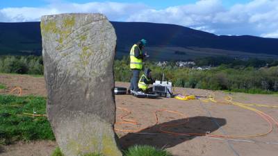
He uses Earth observation techniques to study the cryosphere, including satellite data sets (optical, SAR) and close-range sensing systems, such as radar, terrestrial laser scanners, time-lapse photography, and UAVs.
Will’s recent work has focused on using these instruments to study glacier surges in the Arctic. Alongside this work, he develops tools to bring these data sets together to build digital twins of environmental systems.
View Will’s profileWhere this will take you
Towards a Masters
You’ll earn 15 credits at Masters level (SCQF Level 11) with this course. You can use these credits towards:
Masters in Geographical Information Systems
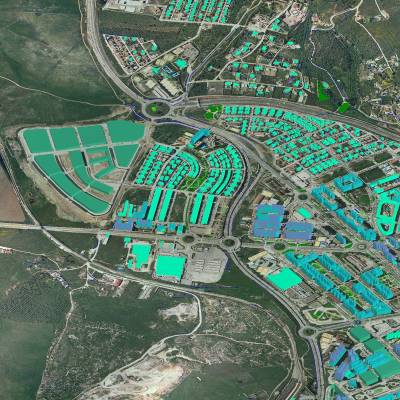
Prepare for a career in the innovative field of Geographical Information Systems (GIS). Build your skills in this essential area of the world’s information infrastructure.
View MSc Geographical Information SystemsCareers with remote sensing training
This course supports careers that involve the collection, analysis, and interpretation of geospatial and Earth observation data.
You’ll develop practical skills in remote sensing and Earth observation that are widely valued across geospatial, environmental, and research sectors, including:
- environmental management
- natural resources management
- agriculture
- forestry
- urban planning
- disaster planning and management, and
- climate science.
Career paths
Your learning in this course can help you progress within or towards roles including:
- GIS Analyst or Geospatial Specialist
- Remote Sensing or Earth Observation Analyst
- Environmental Consultant or Environmental Scientist
- Climate Change and Natural Resource Specialist
- Researcher in environmental, geographical, or geospatial sciences.
The course also provides a strong foundation for postgraduate research.
Continuing Professional Development (CPD)
Your employer or professional institute may recognise this course for CPD hours. Talk to your employer or institute to find out more.

Free career support
Access our free careers service while you study.
- 1:1 appointments
- CV checks
- Interview prep
- Job opportunities
Entry requirements
Entry requirements
We welcome students from all over the world.
This course has no formal entry requirements. You do not need to provide proof of your qualifications.
But you do need to check the entry guidance above to understand the level of teaching delivered, to decide if this course is right for you.
If you do not have qualifications from the UK, check the equivalent teaching level for your country.
Visa requirements
You do not need a student visa to study online with us.
English language requirements
Teaching is delivered in English.
You do not have to provide proof of your English language skills to join this course. But we want to make sure that you can use English well enough to study successfully.
Recommended level of English
For this course, we recommend the following level of English language proficiency.
These are our Postgraduate Standard requirements, and these are minimum scores.
IELTS Academic, IELTS UKVI Academic, or IELTS Online (not IELTS Indicator or IELTS General Training)
- 6.5 overall
- 5.5 for listening, reading and speaking
- 6.0 for writing
TOEFL iBT or TOEFL iBT Home Edition
- 90 overall
- 17 for listening
- 18 for reading
- 20 for speaking
- 21 for writing
- TOEFL DI code is 0818
Cambridge English: B2 First, C1 Advanced, or C2 Proficiency
- 176 overall
- 162 for listening, reading and speaking
- 169 for writing
LanguageCert Academic / LanguageCert Academic SELT
- 70 overall
- 60 for listening, reading and speaking
- 65 for writing
Oxford ELLT Digital – English Language Level Test Online
- 7.0 overall
- 5.0 for listening, reading and speaking
- 6.0 for writing
PTE Academic (online test not accepted)
- 62 overall
- 59 for listening, reading, speaking and writing
Skills for English: SELT
- B2 pass with merit
Duolingo – tests taken from 1 July 2024 onward
- 120 overall
- 95 for listening, reading and speaking
- 105 for writing
University of Aberdeen English Pre-sessional Programme (PSE)
- Pass
- Valid for one year. Refresher can be offered if out of date
Pre-sessional academic English preparation programmes undertaken at other UK universities
- Pass at an equivalent of 6.5 (C1)
- B2 in all four skills
- Certification must be within one year prior to the start of your course
For full information about language requirements, see our English Language Requirements page.
Studying GIS involves storing and processing large datasets. In order to handle this, you need access to adequate computing power. You will need:
A computer (ideally a PC or laptop) with an up-to-date operating system
*A note for Mac users: While you can use a Mac, this may limit running software used in GIS.
Most of the software you’ll use is best suited to a PC or laptop running MS Windows 10 or later. If you use a Mac, we recommend you partition your hard drive so that one partition runs macOS and the other MS Windows.
Alternatively, you can use our Virtual Desktop Infrastructure (VDI) to access and use the software required. Find out about our VDI.
If you’re unsure about the suitability of your hardware, please get in touch with us prior to enrolling so that we can offer guidance. Contact the Online Learning team.
Computer specifications
Any desktop or laptop should be the highest spec you can afford, with:
- a minimum of 16GB RAM (ideally 32GB or more)
- plus graphics card/onboard RAM
- a fast processor
- a large hard drive or SSD (1TB or above).
External hard drive and memory stick
You’ll need some external storage for storing and backing up your data and coursework. We suggest:
- at least a 1TB external hard drive, and
- at least a 32GB memory stick.
Reliable internet access
We recommend:
- a wired connection
- a minimum download speed of 2 Mbps so you can take part fully in live sessions.
Speakers or headphones
- We recommend a headset with built-in microphone and earphones if you’re likely to study in an environment with background noise.
- A webcam is optional, but you may like to use one from some interactive sessions.
Software
We’ll provide access to all the specialist software you require for this course.
We’ll also give you access to Microsoft 365 applications. This means you can use online versions of Microsoft Word, Excel, PowerPoint and OneDrive and install these programs on up to five personal devices.
See our IT requirements article for more information on our IT services.
Fee payment
Your course fee needs to be paid in full before you start your course.
We accept payment via Visa Debit, Visa Credit and Mastercard.
Ways to save
You may be able to get help funding this course via:
- discounts – if any discounts are available for this course, they’ll appear in the section below
- employer sponsorship – we accept full and partial fee payments from sponsors.
Find out more about funding options.
Student card
All our students are entitled to a University of Aberdeen student card. This gives you access to a range of student discounts around the city and online.
Learning resources
Access to all the software, books, and resources you need are included in your tuition fee. They will be available online and you do not have to buy your own copies.
We also provide recommended reading lists. These include books that you may wish to purchase for additional reading, but it is not essential.
Printing
You may wish to set aside a small budget for printing, depending on how you like to work.
Memory stick and / or external hard drive
You may have to purchase a suitable memory stick or external hard drive, if you do not already have these, for storing data and coursework.
We recommend a minimum 1TB external hard drive and a minimum 32GB memory stick. See IT requirements section for more details.
This course has no formal entry requirements. You decide if it’s suitable for you.
The course is delivered at Masters level. At this level, for this course, you’d usually have at least:
- a 2:2 UK honours degree (or equivalent) in a relevant science or applied field, such as: Geography, Engineering, Environmental Science, Computing Science, or Geology, or
- relevant professional experience that supports this level of learning.
Your right to cancel starts on the date of payment of the tuition fees for this course and expires 15 days after the start date of this course.
The University of Aberdeen is not responsible for resolving any issues concerning software, hardware, or internet, in relation to your personal computer and this course.
Please read our full terms and conditions.