Get an introduction to the theory and practice of remote sensing and Geographical Information Systems (GIS).
Study GIS and related geospatial technologies online, including databases, digital mapping and cartography, with experts.
- Build your skills in a range of geospatial tools, technologies, and techniques.
- Learn the basics of digital mapping and geovisualisation.
- Discover the art and science of designing and creating maps and other visualisations of spatial data.
You’ll find out how to collect, manage and edit your own spatial data in this flexible GIS course that fits around full-time work.
Build credits towards a Masters degree
This online course is part of:
You can use the credits you earn on this short course towards either of these MSc qualifications.
What you’ll study
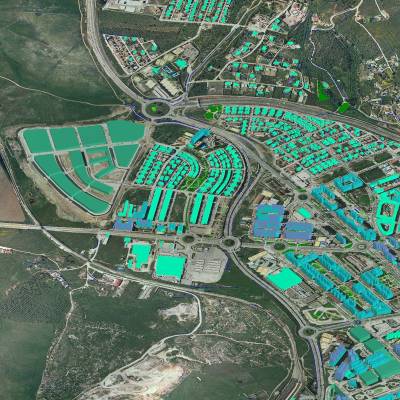
You’ll learn about introductory remote sensing, and a range of fundamental GIS tools and techniques.
This includes navigation, measurement, spatial queries, geocoding, scripting, buffering, digitising, and overlay analysis.
You’ll explore ‘real world’ examples as you learn to apply tools for data exploration, data capture, simple spatial analysis, mapping and visualisation.
You’ll also learn to select the correct approach to a problem, analyse data, and interpret the results.
You’ll cover the following topics:
- Introduction to remote sensing, cartography, digital mapping, and geovisualisation
- Geospatial data sources, data formats, and databases
- Introduction to GIS, for example, ArcGIS/ArcGIS Pro and/or QGIS
- Geospatial data analysis
- Designing and creating a map
- Mobile GIS and apps
- Visual communication
By the end of this course, you’ll be able to…
-
Interpret remote sensing data.
-
Collect your own geospatial data.
-
Input spatial data into a GIS.
-
Store spatial data in a database.
-
Edit spatial data.
-
Use geospatial analysis tools and techniques.
-
Map and visualise spatial data and the results of geospatial analysis.
How you’ll study
Online learning
This distance-learning Introduction to GIS course is delivered flexibly, 100% online. You can study with us anywhere in the world and manage your study hours to suit you.
Your teaching
This course is delivered at the postgraduate level.
Teaching is delivered through MyAberdeen, our online Virtual Learning Environment (VLE). It holds all the materials, tools and support you’ll need in your studies. Take a look around MyAberdeen.
You can access your learning materials on computer, smartphone and laptop, 24 hours a day. You’ll find a range of resources at your fingertips, including, for example:
- online lectures and tutorials
- videos and slide shows
- audio clips
- projects
- reading materials
- the online resources of our award-winning Sir Duncan Rice Library
- discussion boards with colleagues and tutors.
Your tutors
This course is delivered by the School of Geosciences.
You’ll learn from internationally experienced geoscientists and academics. Your course content is also continually reviewed by an industry advisory board. This ensures your learning is always current and aligned to the needs of industry.
This course is assessed online via two assessments.
Assessment 1: Remote sensing
- This first assessment is about the remote sensing part of the course. For this assessment, you will need to use your understanding of the theoretical framework for application of remote sensed data in a real-world scenario.
Assessment 2: GIS
- The assessment about the GIS part of the course consists of report writing based on data analysis and interpretation using simulated or real-world data provided or downloaded from open sources.
Each assessment is worth 50% of your final grade for the course.
Each assessment will be marked based on the University’s Common Grading Scale.
The course totals approximately 150 hours of study and assessment time. That’s around 10 – 15 hours per week.
This is an indicative guide to the time required for a typical student at this level to achieve the learning outcomes.
You can largely set your own study hours each week to cover the materials. MyAberdeen is available 24/7, so you can log in and study when it suits you.
Activities at fixed times
There may be some activities scheduled for fixed times. This could include coursework and assessments with deadlines, or online meetings with your tutor. Otherwise, you can access and work through the course at your convenience.
When you study with us, you can expect a first-class support structure so that you’re never alone in your studies.
But learning online does mean you have to motivate yourself and manage your own time.
Your most important commitment will be time – the time to work through, reflect on and understand your teaching materials.
Before you start a course that involves a high degree of independent study, we recommend looking at the time you will be able to devote to your studies each week:
- Be realistic
- Create a weekly schedule as a guide
If you have any questions about studying online, get in touch with our friendly team. We’re here to help.
Our first-class support structure will ensure that you aren’t alone in your studies. You’ll have contact with your tutors via email, MyAberdeen, and phone. You can use social media and discussion boards to chat with your fellow students too.
We provide a wide range of services to support you in your studies and beyond:
- Careers and Employability Service
- Disability support
- IT support
- Library support
- Student Support Service – help with finances, stress, wellbeing and non-academic issues
- Student Learning Service – study support, with advice sessions available via phone or Skype
- Aberdeen University Students’ Association (AUSA) – run by students for students
- Toolkit – clever apps and free training that can make your study life easier
Wherever you are in the world, you’ll feel part of our very special Aberdeen learning community.
Your teaching team

Dr David R. Green
David heads our MSc in GIS and our UAV Centre for Environmental Monitoring and Mapping. He is past-Chairman of the Association for Geographic Information (AGI) and past-Editor in Chief of The Cartographic Journal. He specialises in environmental applications of geospatial technologies including remote sensing, GIS, cartography, WebGIS, Smart Technologies, and drones (UAVs); and hydrography.
View David’s profile
Dr Charles Wang
Charles is a Reader in Physics and Cruickshank Lecturer in Astronomy. He graduated from the National Taiwan University and Cambridge University and obtained his PhD from Lancaster University. He has championed theoretical research in astronomy and gravitation, with strong links to tests in space and the laboratory.
View Charles’ profile
Dr Shaktiman Singh
Shaktiman is an environmental scientist specialising in glacio-hydrological research. He uses GIS tools to solve the problems of land and water resource management. Shaktiman is skilled in large geospatial data analyses, spatial modelling, and automation in GIS.
View Shaktiman’s profileWhere this will take you
Towards a Masters
You’ll earn 15 credits at Masters level (SCQF Level 11) with this course. You can use these credits towards:
Masters in Geographical Information Systems
Prepare for a career in the innovative field of Geographical Information Systems (GIS). Build your skills in this essential area of the world’s information infrastructure.
View MSc Geographical Information Systems
Masters in Energy Transition Systems and Technologies
Join an online MSc that’s training the next generation of systems engineers. Help our planet transition from oil and gas to net-zero, with a degree you can study online, part-time.
View MSc Energy Transition Systems and TechnologiesCareers
This short course will help you prepare for a career in GIS. You could work towards becoming a:
- GIS Officer
- GIS Technician.
You could find GIS-related roles in local or national government, environmental agencies, the commercial sector, research or academia.
Your employer or professional institute may recognise this course for Continuing Professional Development (CPD). Talk to your employer or institute to find out more.

Free career support
Access our free careers service while you study.
- 1:1 appointments
- CV checks
- Interview prep
- Job opportunities
Entry requirements
Entry requirements
We welcome students from all over the world.
This course has no formal entry requirements. You do not need to provide proof of your qualifications.
But you do need to check the entry guidance above to understand the level of teaching delivered, to decide if this course is right for you.
If you do not have qualifications from the UK, check the equivalent teaching level for your country.
Visa requirements
You do not need a student visa to study online with us.
English language requirements
Teaching is delivered in English.
You do not have to provide proof of your English language skills to join this course. But we want to make sure that you can use English well enough to study successfully.
Recommended level of English
For this course, we recommend the following level of English language proficiency.
These are our Postgraduate Standard requirements, and these are minimum scores.
IELTS Academic, IELTS UKVI Academic, and IELTS Online (not IELTS Indicator or IELTS General Training)
- 6.5 overall
- 5.5 for listening, reading and speaking
- 6.0 for writing
TOEFL iBT and TOEFL iBT Home Edition
- 90 overall
- 17 for listening
- 18 for reading
- 20 for speaking
- 21 for writing
- TOEFL DI code is 0818
Cambridge English: B2 First, C1 Advanced, or C2 Proficiency
- 176 overall
- 162 for listening, reading and speaking
- 169 for writing
LanguageCert Academic/LanguageCert Academic SELT
- 70 overall
- 60 for listening, reading and speaking
- 65 for writing
LanguageCert International ESOL B2 Communicator (Written and Spoken) – Online / In-centre
- Overall High Pass
- 33 for listening, reading and speaking
- 38 for writing
Oxford ELLT Digital – English Language Level Test Online
- 7.0 overall
- 5.0 for listening, reading and speaking
- 6.0 for writing
PTE Academic (online test not accepted)
- 62 overall
- 59 for listening, reading, speaking and writing
For full information about language requirements, see our English Language Requirements page.
Studying GIS involves storing and processing large datasets. In order to handle this, you need access to adequate computing power. You will need:
A computer (ideally a PC or laptop) or Mac operating on either
- Windows 10 or later
- macOS 10.15 (Catalina) or later (see note for Mac users* below).
*A note for Mac users
While you can use a Mac, this may limit running software used in GIS.
Most of the software you’ll use is best suited to a PC or laptop running MS Windows 10 or later. If you use a Mac, we recommend you partition your hard drive so that one partition runs macOS and the other MS Windows.
Alternatively, you can use our Virtual Desktop Infrastructure (VDI) to access and use the software required. Find out about our VDI.
If you’re unsure about the suitability of your hardware, please get in touch with us prior to enrolling so that we can offer guidance. Contact the Online Learning team.
Computer specifications
Any desktop or laptop should be the highest spec you can afford, with:
- a minimum of 8 to 16GB RAM (ideally 32GB or more)
- plus graphics card/onboard RAM
- a fast processor
- a large hard drive or SSD (1TB or above).
External hard drive and memory stick
You’ll need some external storage for storing and backing up your data and coursework. We suggest:
- at least a 1TB external hard drive, and
- at least a 32GB memory stick.
Reliable internet access
We recommend:
- a wired connection
- a minimum download speed of 2 Mbps so you can take part fully in live sessions.
Speakers or headphones
- We recommend a headset with built-in microphone and earphones if you’re likely to study in an environment with background noise.
- A webcam is optional, but you may like to use one from some interactive sessions.
Software
We’ll provide access to all the specialist software you require for this course.
We’ll also give you access to Office365 applications. This means you can use online versions of Microsoft Word, Excel, and PowerPoint and install these programs on up to five personal devices.
See our IT requirements article for more information on our IT services.
Fee payment
Your course fee needs to be paid in full before you start your course.
We accept payment via Visa Debit, Visa Credit and Mastercard.
Ways to save
You may be able to get help funding this course via:
- discounts – if any discounts are available for this course, they’ll appear in the section below
- employer sponsorship – we accept full and partial fee payments from sponsors.
Find out more about funding options.
Student card
All our students are entitled to a University of Aberdeen student card. This gives you access to a range of student discounts around the city and online.
This course has no formal entry requirements. You decide if it’s suitable for you.
The course is delivered at Masters level. At this level, you’d usually have at least:
- a 2:2 UK undergraduate degree (or equivalent), or
- relevant experience that supports this level of study.
Apply for this course